A Re-birth Course: Discovering the Primeval Korean Peninsula to Refresh Your True Self
8 stops · Approx. 7 hours 30 minutes
Catch a glimpse of the primeval Korean Peninsula across Yeoncheon, Cheorwon, Hwacheon, Inje, and Goseong. This course takes you on a stroll through deep, lush forests and lakeside nature, visiting beautifully landscaped arboretums and the northernmost unification observatory.
- Duration
- Approx. 7 hours 30 minutes
- Distance
- Approx. 430 km
Along the way
- 1Jeongok Prehistory Musuem
전곡선사박물관
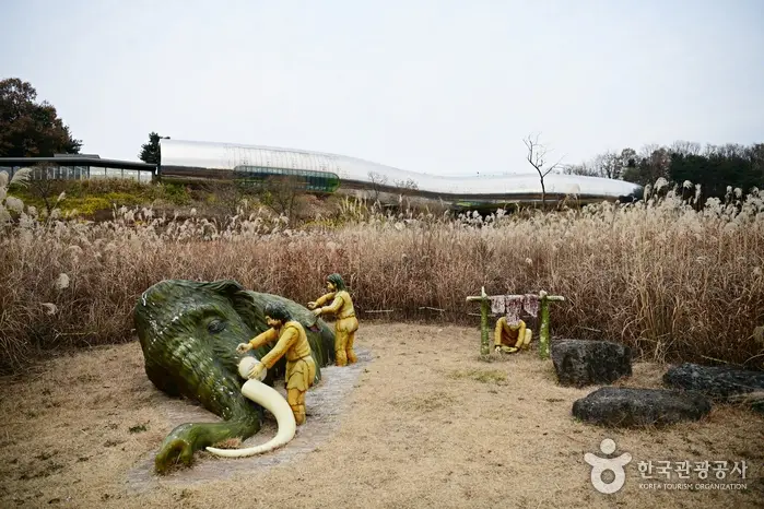
Jeongok Prehistory Museum is a site museum built on the Jeongok-ri Paleolithic Site, a historic location where the discovery of East Asia's first Acheulean-type handaxe rewrote the global history of Paleolithic research. Centered around Paleolithic artifacts unearthed from the Jeongok-ri site, such as Acheulean handaxes, the exhibition space is organized with diverse themed displays to help visitors systematically understand human evolution and Paleolithic culture.MoreLess

- 2
Jaein Falls (Hantangang River National Geopark)
재인폭포 (한탄강 국가지질공원)
Boasting one of the most scenic and breathtaking landscapes along the Hantangang River, Jaein Falls has long been widely renowned as a scenic destination. The sight of a small stream flowing down from Jijangbong Peak to the north, cascading over basalt columnar joint cliffs approximately 18 meters high, is truly spectacular. The area surrounding Jaein Falls is also known as a habitat for the natural monument Manchurian trout (Eumeces/Hemibarbus mylodon) and the endangered silene (Silene capitata), along with a beautiful legend of love associated with the waterfall's name. At Jaein Falls, visitors can observe various basalt volcanic features, most notably columnar joints, river sea caves, potholes, and gas tubes. The 18-meter-high waterfall has continually eroded the riverbed beneath it, creating a plunge pool (pothole) reaching a depth of about 5 meters. A pothole refers to a deep hollow formed in river rocks when swirling water currents (vortices) erode concave or fractured spots.MoreLess
- 3Hantangang River Jusangjeolli-gil
철원 한탄강 주상절리길(잔도)
Located in the Hantangang River basin, designated as a UNESCO Global Geopark, the Cheorwon Hantangang River Jusangjeolli-gil (Cliffside Walkway) allows visitors to enjoy an up-close view of the river's blessed natural scenery. Scale: Length 3.6 km / Width 1.5 m Address: Deureuni Ticket Office (033-452-9825 / San 174-3, Guntan-ri), Sundam Ticket Office (033-452-2225 / San 78-2, Guntan-ri) Hours: 09:00–16:00 (Last entry at 15:00) Operation: Limited to 300 visitors per sessionMoreLess
- 4
Bisugumi Village (Bisugumi Valley)
비수구미마을(비수구미계곡)
Bisugumi Village is famous for its pristine, pollution-free valley with crystal-clear waters. Dense virgin forests and expansive flat rocks stretch alongside the valley. Together with Paroho Lake, it is a renowned autumn destination for family travelers.MoreLess
- 5
Hwacheon Banjigyo Bridge & Arles Theme Arboretum
화천 반지교&아를테마수목공원
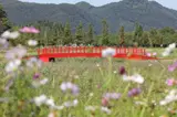
Arles Theme Arboretum is the renamed site of what was formerly known as the Georye-ri Love Tree. The arboretum is quiet and ideal for healing, and it is very popular among cycling enthusiasts as it connects directly to the Bukhangang River Bicycle Path. In addition, the ring-shaped Banjigyo Bridge located at the end of the arboretum trail makes it a popular spot for marriage proposals and couple photos.MoreLess
- 6Bangtaesan National Recreational Forest
국립 방태산자연휴양림
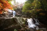
Bangtaesan Mountain is often described as Korea's version of Noah's Ark, echoing its name (meaning fragrant boat). The mountain's name changed from 芳臺山 to 芳台山, and Bangdaecheon Stream still flows through its valley. At the summit of Bangtaesan Mountain, there used to be a boulder weighing around two tons with a hole chiseled into it by hand. Legend has it that during an ancient great flood, a rope was tied to it to keep a boat from drifting away; hence, the rock was called Baedaleun Dol (Boat-Mooring Rock, 1,415.5 m above sea level). As if proving those times, it is said that seashells are still found in the soil and sand among rock crevices at the peak, though that specific rock can no longer be seen today. The vegetation of Bangtaesan consists mostly of natural broadleaf forest along with some reforested areas. The valleys from the main peaks, Guryongdeokbong Peak (1,388 m above sea level) and Jueokbong Peak (1,443 m above sea level), serve as headwaters that form the main stream system of the recreation forest, providing an abundant water flow. In particular, Madangbawi Rock (a flat, wide rock resembling a courtyard) and the two-tiered waterfall are magnificent sights. With diverse tree species such as linden, birch, pine, and oak, the natural scenery is splendid throughout the seasons with verdant greenery, autumn foliage, and snowscapes. The area is also home to diverse wildlife, including freshwater fish like Lenok trout, catfish, and Korean dark sleeper, as well as wild boars, rabbits, pheasants, roe deer, and squirrels. * Total Area - 9,387 haMoreLess
- 7
Gangwon Pyeonghwa Nuri-gil Course 17: Goseong Songjiho Migratory Bird Trail
강원평화누리길 17코스 고성 송지호 철새길
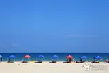
Gangwon Pyeonghwa Nuri-gil is a trekking and cycling trail that connects the border areas from Ganghwado Island on the west coast, adjacent to North Korea, to Goseong on the east coast. Specifically, the Gangwon-do section passes through Cheorwon, Hwacheon, Yanggu, Inje, and Goseong, comprising 20 courses with a total length of 361.2 km. Pyeonghwa Nuri-gil is highly recommended for those wishing to experience a path connecting the history of division with scenic nature.MoreLess
- 8
Goseong Unification Observatory
고성 통일전망타워
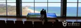
Standing on the Unification Observatory located on a hill 70 meters above sea level, where the Military Demarcation Line and the Southern Limit Line meet, you can see Guseonbong Peak and Haegeumgang of Geumgangsan Mountain close at hand, and on clear days, Ongnyeobong, Chaehabong, and Ilchulbong Peaks. Frontline guard posts confronting each other across the barbed wire fence below allow visitors to sense the tension between South and North Korea. As a premier tourist destination in Goseong visited by over 1.5 million tourists annually, it features religious facilities such as the Statue of the Virgin Mary, Maitreya Buddha Statue, and the Jeonjin Steel Tower for displaced persons missing their hometowns and families in the north, as well as security education exhibits such as armored vehicles, tanks, and airplanes. Below your eyes, you can also see the Donghae Line inter-Korean connecting road opened in December 2004, which facilitated overland tourism to Geumgangsan Mountain.MoreLess
Source: Korea Tourism Organization (TourAPI) · Machine-translated