Haeparang Trail (Gyeongju, Pohang, and Yeongdeok Section)
7 stops · 3 nights or more
The Haeparang Trail is the longest walking trail in South Korea, spanning a total of 750 km starting from Oryukdo Island in Busan. This itinerary covers the sections passing through Gyeongju, Pohang, and Yeongdeok. Visitors can explore the Tomb of King Munmu, Gameunsaji Temple Site, and Igyeondae Pavilion in Gyeongju. In addition, the course includes Yangpohang Port, Janggieupseong Walled Town, and Malmokjangseong Fortress Wall in Pohang, as well as Goesi-ri Traditional Village in Yeongdeok.
- Duration
- 3 nights or more
- Distance
- 77.7km
Along the way
- 1Tomb of King Munmu
경주 문무대왕릉
Located in the sea off Bonggil-ri, about 200 meters from the mainland, is a rocky islet that serves as the underwater tomb of King Munmu (reigned 661–681), the 30th king of Silla who achieved the unification of the Three Kingdoms. Cross-shaped waterways running east-west and north-south are carved into the rocky islet, which has a circumference of about 200 meters, forming a small pool-like basin in the center. A large stone measuring 3.6 meters long, 2.85 meters wide, and 0.9 meters thick is placed at a water depth of 2 meters, and it is presumed that his remains were placed underneath. However, debate continues among scholars over whether his ashes were scattered after cremation or his remains were directly enshrined. This large rock is called Daewangam and is designated as a Historic Site.MoreLess
- 2Gameunsaji Temple Site
경주 감은사지
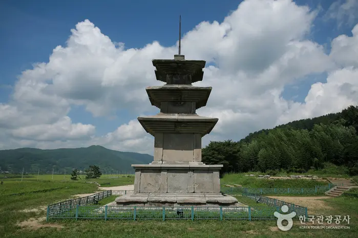
Gameunsa was a Buddhist temple of the Silla period. After achieving the great feat of unifying the Three Kingdoms, King Munmu, the 30th monarch of Silla, began building a temple at this site to ward off Japanese invasions through the power of the Buddha. However, he passed away before its completion, and his son, King Sinmun, completed it in 682, the second year of his reign, following his father's will. Before his death, King Munmu left a will stating that he wished to become a dragon of the East Sea to protect the country and requested to be cremated and buried in the East Sea. The place where he was buried in accordance with his wishes is Daewangam, and it is said that King Sinmun completed the temple in gratitude for his father's grace and named it Gameunsa. The current site reflects the results of a two-year comprehensive excavation conducted from 1979, exposing and restoring the building foundations as they were at the time of construction. It also revealed a special structure under the main hall designed as a symbolic resting space for King Munmu, who became a sea dragon, along with traces of a passageway opening toward the east. The two soaring three-story stone pagodas are early Unified Silla pagodas of clearly confirmed age, built with an assemblage of dozens of parts; standing at a total height of 13.4 meters, they are the largest three-story stone pagodas of Silla.MoreLess
- 3
Igyeondae Pavilion, Gyeongju
경주 이견대
There are two meaningful spots for viewing Daewangam. One is Igyeondae Pavilion in front of Daebon Elementary School, and the other is the site where the monument "My Unforgettable Sea" stands below the East Sea Gateway (Donghaegu) marker stone. Igyeondae Pavilion is a historic place where King Munmu, who chose to become a dragon of the East Sea to protect the nation rather than have a lavish tomb, is said to have appeared in the form of a dragon, and where his son, King Sinmun, obtained the Manpasikjeok, an invaluable treasure that could not be traded even for immense wealth. The name Igyeondae is derived from the phrase "A flying dragon in the sky; it is beneficial to see a great man" (飛龍在天 利見大人) in the I Ching (Book of Changes). The current building was recently reconstructed based on foundation stones uncovered during an excavation in 1970. Going down below the Donghaegu marker stone leads to the monument "My Unforgettable Sea," erected in 1985 by disciples to honor the anti-Japanese spirit of scholar U-hyeon Ko Yu-seop. As if refuting Japan's forced justification of clear invasion under the pretext of "Naisen Ittai" (Japan and Korea as One Body) during the Japanese colonial period, Ko Yu-seop composed the poem "Daewangam" reflecting on King Munmu's patriotic determination against Japanese incursions back in the Unified Silla era. The poem and the monument "My Unforgettable Sea" stand side by side overlooking Daewangam, adding deeper meaning to the site.MoreLess
- 4
Yangpohang Port
양포항
Yangpohang Port is a fishing port located in Nam-gu, Pohang-si, Gyeongsangbuk-do. Many people enjoy fishing around the port where fishing boats dock, as well as along the breakwater. In addition, Yangpohang is a popular destination for anglers because fishing boats regularly depart from here. The main fish species caught around Yangpohang include flounder, yellowtail, Atka mackerel, and octopus. In the vicinity of Yangpohang Port, there are fishing tackle shops, supermarkets, restaurants, and pensions. Traveling northward from Yangpohang Port leads consecutively to Guryongpohang Port, Guryongpo Beach, and Homigot Sunrise Square. Heading south makes it convenient to explore linked attractions, as several beaches are located around Gampo in Gyeongju.MoreLess
- 5
Janggieupseong Walled Town, Pohang
포항 장기읍성
Janggi-myeon in Pohang-si borders Gampo-eup in Gyeongju-si. Along the East Sea coast, there are travel attractions such as Yangpohang Port and Daejin Beach, and following that coastal road further north leads to Guryongpohang Port and Janggigot Point. Located on the eastern slope of Dongaksan Mountain (252.5 m) in Eumnae-ri, Janggi-myeon, Janggieupseong Walled Town (Historic Site) suffered tribulations during the Japanese colonial period. At that time, all government office buildings within the walled town were destroyed by the Japanese; only the local Confucian school (hyanggyo) was restored and maintained by local residents, while most of the fortress walls covered in weeds have collapsed. Along with other coastal walled towns guarding the East Sea, this fortress served as an important military stronghold due to the geographical topography of the Janggi region. Various records suggest that Janggieupseong was an ancient fortress dating to before the Goryeo period. Meanwhile, this area was treated as a remote outpost and used as a place of exile, where prominent scholars such as Uam Song Si-yeol and Dasan Jeong Yak-yong spent periods of banishment. In particular, Jukrimseowon Confucian Academy was built to honor Song Si-yeol, turning the area into a village of scholars. Rather than having distinct political, economic, or social features, it functioned primarily as a strategic military outpost responsible for national defense. Yeongil Janggieupseong Walled Town was later renamed Pohang Janggieupseong Walled Town.MoreLess
- 6
Guryongpo Malmokjangseong Trail
구룡포 말목장성탐방로
The Guryongpo Malmokjangseong Trail is a perimeter trail created in 2009 after the Guryongpo-eup Office excavated approximately 4 km of a stone fortress site. A two-story observatory was installed at the summit at an elevation of 205 meters, offering panoramic views of the scenic coastal village of Guryongpo and the ridgeline of the Homi Peninsula on the Taebaek Mountain Range. Azaleas, amur chrysanthemums, and other plants are cultivated near the summit, providing a variety of sights for visitors. The stone fortress of Malmokjang refers to a stone fence used for raising horses. Although the exact construction period is unknown, records such as the Samguk Yusa (Memorabilia of the Three Kingdoms) suggest that the horse ranch has a history of about 1,400 years. Originally, the wall stretched about 8 km from Guryongpo to Heunghwan-ri, Nam-gu, but 5.6 km remains today. It is said that a sixth-rank official managed the ranch, while ranch workers (mokjagun) lived here and performed chores such as clearing manure.MoreLess
- 7
Goesi-ri Traditional Village
괴시리 전통마을
Lined with around 30 traditional houses that are over 200 years old, Goesi-ri Traditional Village is a single-clan village of the Yeongyang Nam clan, who have lived here for over 400 years in an auspicious topography shaped like the Chinese character "eight" (八). The vast Yeonghae Plain unfolds in front of the village. It was originally called Hojigol because there was once a pond (hoji) here, and it is also known as Hoji Village. The current name of the village, Goesi, originated during the 8th year of King Gongmin of Goryeo, when a visiting Chinese envoy who was a close friend of scholar Mogeun Yi Saek remarked that the landscape of the village resembled Hojichon of Goesiri, Sugu, Fengmian, leading to the name Goesi-ri. Six historic houses, including the Head House of the Goesi Branch of the Nam Clan, are designated and managed as cultural heritage properties, representing rare historic houses seldom seen even within the province.MoreLess
Source: Korea Tourism Organization (TourAPI) · Machine-translated