A Landscape Where Time Seems to Have Stood Still
5 stops · 1 day
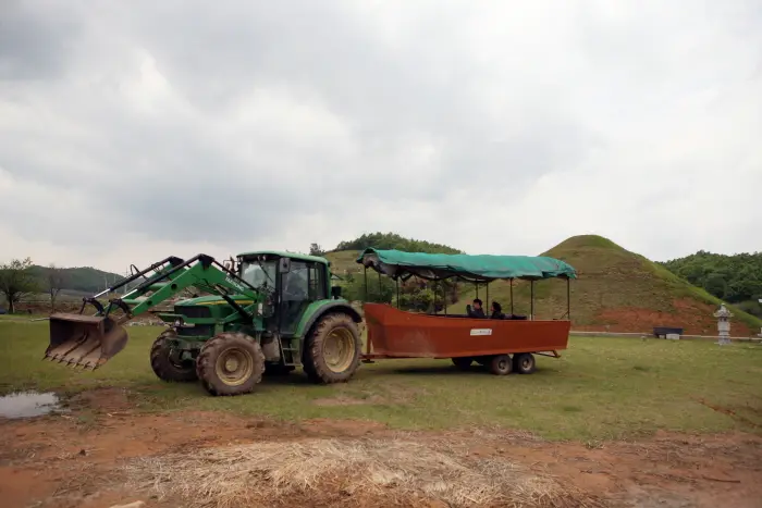
Located in the northernmost part of Gyeonggi-do along the frontline border, Yeoncheon is an optimal destination where you can enjoy both ecotourism and security tourism within the Civilian Control Zone. Here, you can find riverside columnar joints typically seen on continental landmasses. Going further upstream along the Imjingang River from the columnar joints leads to Jangpanaru Ferry. In the past, it was a major passage connecting Hanyang and Hamgyeong-do. Behind Jangpanaru sits Narutbae Village, which is popular for its hands-on farming experiences and tractor tours around the Civilian Control Line. ※ DMZ Peace Train operations are currently suspended to prevent the spread of COVID-19.
- Duration
- 1 day
- Distance
- 64.01km
Along the way
- 1
Yeoncheon Saedungji Village
연천 새둥지마을
Yeoncheon Saedungji Village is a rural experience village located in Gumi-ri, Baekhak-myeon, Yeoncheon-gun, at the northernmost point of Gyeonggi-do. It operates various programs such as farming experiences, harvest experiences, water play experiences, farmstays, long-stay weekend farm Kleingarten, traditional food experiences, direct farm produce sales, and green eco-learning for youth, striving to foster happy exchanges between urban and rural communities.MoreLess

- 2
Yeoncheon Narutbae Village
연천 나룻배마을
Buksam-ri Village is a northernmost village adjacent to the Military Demarcation Line, where the clean Imjingang River flows and ferries used to travel. In Wangjing-myeon, residents live in four ri (Mudeung, Nodong, Dongjung, and Buksam), while three ri (Gangnae, Gangseo, and Jakdong-ri) are farming areas within the Civilian Control Zone where agricultural activities are conducted to produce safe crops. Originally an area of Buk-myeon in Majeon-gun, it was named Buksam-ri after merging three northern ri including Oegok-ri, Jingpa-ri, and Aedong-ri during the 1914 administrative reorganization and incorporated into Wangjing-myeon. Although administrative control was restored on November 17, 1945, under the [Provisional Administrative Measures Act for Reclaimed Areas], it remains within the Civilian Control Zone, so civilians reside in only part of the area.MoreLess
- 3
DMZ Peace Train
평화열차 DMZ 트레인
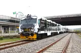
The 'DMZ Peace Train' is the only train heading to the DMZ, an area reborn with great vitality of nature overcoming the scars of history. The DMZ train consists of three cars—Peace Room, Harmony Room, and Love Room—and offers amenities such as a cafe, observation seats, photo zones, and a photo gallery. The photo gallery features around 150 themed photographs on war, ecology, and trains, allowing visitors to reflect on the past and evoke memories. Inside the moving train, crew members organize various events to entertain travelers, and screens in each car show the scenery outside the front and back of the moving train. Taking the DMZ-train allows you to freely explore Dorasan Station, Dora Observatory, and Dorasan Peace Park on foot inside the Civilian Control Line, and you can also take a connecting bus in front of Dorasan Station to visit the 3rd Tunnel and Dora Observatory.MoreLess
- 4
Godaesan Mountain
고대산
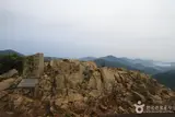
Adjacent to Sintan-ri Station in Yeoncheon-gun—the terminus where the Gyeongwon Line was cut off on the way to Geumgangsan Mountain—Godaesan Mountain (832.1 m) preserves a pristine natural landscape and well-protected ecosystem. It is the only place in the country where you can look out over North Korean territory while hiking, making it perfect for a hiking trip. The origin of Godaesan (高臺山) Mountain is called "Keun Gorae" (big flue), which appears to be linked to the place name Sintan (firewood/charcoal) and refers to "Banggorae" (the furrow under the floor stones through which fire and smoke pass in a traditional firewood-heated ondol room). It is named Godaesan (高臺山) because the valleys are deep and high.MoreLess
- 5Typhoon Observatory
태풍전망대
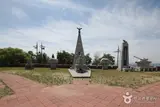
Established on December 3, 1991, by the invincible Typhoon Division, Typhoon Observatory is located on Suribong Peak, the highest point of Bikkisan Mountain in Jung-myeon, about 65 km from Seoul and about 140 km from Pyeongyang. Initially, the Southern Limit Line and Northern Limit Line were set 2 km away from the Military Demarcation Line, but as North Korea installed barbed-wire fences near the Demarcation Line in 1968, South Korea also partially installed fences in 1978. Typhoon Observatory is located 800 m from the Demarcation Line and 1,600 m from the North Korean guard post, making it famous as the observatory closest to North Korea along the 155-mile Military Demarcation Line. MoreLess
Source: Korea Tourism Organization (TourAPI) · Machine-translated