Healing Travel Course in Taebaek-si, Gangwon-do
4 stops · 7 hours
This course is highly recommended if you are planning a solo trip. Traveling alone offers time for deep reflection and thinking back on life, though it can feel slightly awkward or lonely if it is your first time. However, with lively traditional markets full of local charm and a unique cave exploration experience along the way, you won't have any time to feel awkward or lonely.
- Duration
- 7 hours
- Distance
- 41.53km
Along the way
- 1Miinpokpo Falls
미인폭포
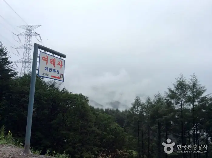
Miinpokpo Falls is located in a southern mountain valley of Simpo-ri, Dogye-eup, halfway between Tong-ri and Sin-ri in Taebaek-si. Stream waters originating from the valley of Ubosan Mountain in Simpo-ri crash against the cliff, creating water droplets where the smaller sprays resemble a fountain and the larger ones evoke a snowy mountain peak. The plateau northeast of the waterfall and the valley above have long been known as a birthplace of beautiful women. Nearby is Miinmyo (Beauty's Tomb). According to legend, a beautiful woman married, but after her husband died early, she remarried. When her second husband also passed away, she threw herself off this waterfall. Another tale says that after her husband died, she looked for another groom to remarry, but finding no one comparable to her late husband, she despaired over her fate and leaped into the waterfall, which gave the waterfall its name, "Miin (Beauty) Falls." MoreLess
- 2
Tongri Market (5th, 10th)
통리장 (5, 10일)
Tongri 5-Day Market, which opens in rotation on days ending in 5 and 10, forms a 500-meter marketplace along a 10-meter-wide village back road crossing a natural village near Tongri Station. Arranged in a one-way oval shape, its unique layout is considered its greatest charm and advantage. Today, around 300 vendors participate, making it a new local attraction and must-visit sightseeing spot. MoreLess
- 3
Geomnyongso Spring
검룡소
Geomnyongso is the source of the Hangang River. Underground water surging through a 20-meter-circumference limestone rockbed of bottomless depth immediately cascades into a 20-meter waterfall, creating a magnificent spectacle. Over long years of water flow, the bedrock has been deeply gouged 1 to 1.5 meters deep and 1 to 2 meters wide in winding curves, making the flowing water resemble a writhing dragon. Legend says a black dragon (geomnyong) lives here, which is how it earned the name Geomnyongso. The surrounding bedrock is covered with lush green water moss, lending it a mystical appearance. As a nature reserve, the area serves as a living classroom for ecological learning, and the Hangang Grand Festival is held here annually on Yudu Day (the first Sunday of August). MoreLess
- 4
Yongyeon Cave
용연동굴
Yongyeon Cave is situated at an elevation of 920 meters on the lower ridge of Geumdaebong Peak, the backbone of the Baekdudaegan Mountain Range. The exact year it was first opened to the public is unknown, but calligraphy inside the deep cave tells of people taking refuge during the Japanese invasions of Korea (Imjin War). According to lore, it served as headquarters for righteous armies (uibyeong) and as a refuge during national crises. Left exposed to the public for a long time without special protection, its formations like stalactites and stalagmites suffered severe damage. However, on February 26, 1980, it was designated as Gangwon-do Monument No. 39, and access control structures were installed at the entrance for protection. Subsequently, permission for public disclosure of cultural heritage was granted on September 23, 1994, leading to the construction of cave exploration facilities for development. MoreLess
Source: Korea Tourism Organization (TourAPI) · Machine-translated